Digital Spatial History
These websites will provide you with current examples of digital spatial history in action.
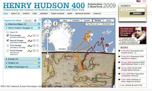
Henry Hudson 400
http://www.henryhudson400.com/home.php
This site commemorates the 400th anniversary of Henry Hudson's voyage for the Dutch to the Hudson river and New York, and celebrates the history of Henry Hudson, Amsterdam and New York City. It offers an opportunity to "explore present-day and historical information using Google Maps."
Atlas of early printing
This site depicts the spread of printing through Europe in the fifty years following the European refinement of the tools and process to make impressions from movable type cast in metal.
HyperCities
As described on their web page, "HyperCities is a collaborative research and educational platform for traveling back in time to explore the historical layers of city spaces in an interactive, hypermedia environment." This is a rich and dynamic website which is expanding quickly, but it can sometimes be overwhelming.
MediaNola
http://medianola.tulane.edu/index.php/Main_Page
Since January 2009, Media Nola has been a collaboration of Tulane students, programmers, archivists, and staff working with archivists and nonprofit organizations around the city to tell the history of important sites of New Orleans cultural and mediated production from 1880 to 1980. It is an ongoing project. Each student focused on 3-5 different locations (actual places of business) and wrote histories of them. The entries are of varying quality and complexity, but this is an interesting example of the use of a wiki in the digital humanities classroom.


