Geospatial Portals
These links show examples of how different projects display their geospatial data. Review these sites to get an idea of the different formats and interfaces currently being employed in geospatial portals.
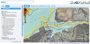
Mecklenburg County GeoPortal
http://maps.co.mecklenburg.nc.us/geoportal/
GeoPortal is an advanced web mapping system created by Mecklenburg County GIS. Its mission is to be an easy-to-use "portal" to Mecklenburg County's data and services. This site is powered by free and open source software.
University of Virginia Library Geospatial Data Portal
http://lat.lib.virginia.edu:8080/geonetwork/
This geospatial portal contains data pertaining primarily to the infrastructure, land use, and natural features within the County of Arlington, Virginia. Its "Where? + What? + When? = Search" toolbar is an interesting approach to developing a user-friendly interface. See also the UVA library Scholars' Lab, which sponsors the geospatial data portal: http://www2.lib.virginia.edu/scholarslab/
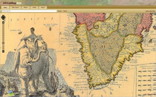
Africa Map
The intention of this geospatial portal, designed by members of Harvard University, is to provide one common source for students, researchers and the general public to interact with and accumulate the best public (historical and contemporary) data available about Africa.
European Commision's Geo-Portal
http://www.inspire-geoportal.eu/
As described by its website, "the INSPIRE geoportal provide the means to search for spatial data sets and spatial data services, and . . . view and download spatial data sets from the EU Member States".
GeoPortail
Offering its services in several languages, this geoportal is France's answer to Google Maps.


