
Driving Through Time - The Digital Blue Ridge Parkway

Search Results:
-
 Shoulder construction, High Piney Ridge in background
1938
-
Fire Hazard Map
1939
-
 Hand Rail
January 1, 1939
-
 #4 Arch Bridge, Masonry Detail
January 10, 1939
-
 #4 Arch bridge Masonry detail
January 10, 1939
-
 Sheds (Torn down by BLRI 2/1/39)
January 18, 1939
-
 Old barn on left, to be removed
January 18, 1939
-
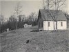 Osbourne and Richardson Property. West of House
March 30, 1939
-
 Richardson Property between Richardson and Osborne Houses
March 30, 1939
-
 Cleary, Osbourne and Richardson Property Below Cleary property
March 30, 1939
Items in Query
Results: 24
Refine Your Search
Types (2)
Photographs (23) Maps (1)Locations (10)
Milepost 229 (11) Section 2A (3) Cumberland Knob (2) Milepost 224 (2) Milepost 217 (1) Milepost 218 (1) Milepost 219 (1) Milepost 222 (1) Milepost 226 (1) Milepost 227 (1)Sections (1)
2A (24)Counties (1)
Alleghany (24)

