Driving Through Time - The Digital Blue Ridge Parkway
Search Results:
- 1.
Gilam Gap
December 20, 1934 - 2.
Gilam Gap Overlook
December 20, 1934 - 3.
Gilam Gap
December 20, 1934 - 4.
Gillam Gap
May 28, 1935 - 5.
Dry Masonry Fireplace
June 19, 1935 - 6.
Big Fill to Right of Picture
June 19, 1935 - 7.
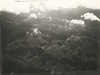
Watkins Dome from air
June 19, 1935 - 8.
Overpass location at Benge (back)
June 19, 1935 - 9.
Dry Masonry Fireplace
June 19, 1935 - 10.
Mountain Laurel
June 20, 1935 - 11.
Flame Azalea
June 21, 1935 - 12.
Detail Map
1936 - 13.
Early Construction
August 2, 1936 - 14.
Early Construction
August 2, 1936 - 15.
Jeff Anderson and some sample stone, 6 foot rule sample 6
February 21, 1936 - 16.
Rock cut near South Fork New River
February 21, 1936 - 17.
Fill and Box Culvert
May 7, 1936 - 18.
Fill and box culvert
May 7, 1936 - 19.
Cut Slopes
May 7, 1936 - 20.
Road relocation (pines to be welled)
May 8, 1936 - 21.
Grade crossing, Daniels Gap before revision
May 8, 1936 - 22.
Stone Steps W.M.L. Miller's house, possible quarry
May 8, 1936 - 23.
Tree Wall
June 3, 1936 - 24.
County road relocation and crossing
June 3, 1936 - 25.
Early Construction
June 27, 1936 - 26.
View of Proposed Crossing of NC 18 (2)
June 28, 1936 - 27.
Proposed Site for Border of Section C and Section D
June 28, 1936 - 28.
Proposed Parkway Crossing of NC Route 18 (1)
June 28, 1936 - 29.
Proposed Crossing of NC 18 (3)
June 28, 1936 - 30.
Early Construction
July 31, 1936 - 31.
Early Construction
August 1936 - 32.
County Road, vicinity of sec. 2D, looking south over ridges which carry parkway
August 1936 - 33.
Hand-laid rock embankment
August 14, 1936 - 34.
Hand-laid rock embankment detail
August 14, 1936 - 35.
Handlaid rock embankment
August 14, 1936 - 36.
Hand-laid rock embankment construction
August 14, 1936 - 37.
Early Construction
August 20, 1936 - 38.
Cabin within 100 foot right-of-way of the Parkway.
September 10, 1936 - 39.
View of log cabin in vicinity of parkway
September 10, 1936 - 40.
View from right bank of road looking north showing a pine wooded area through which the parkway travels.
September 11, 1936 - 41.
Property of Robert L. Doughton Opposite 2D
September 11, 1936 - 42.
Right headwall culvert, Type 3
September 21, 1936 - 43.
View of typical mountain cabin and surrounding area along road from Jefferson to Glendale Spring, NC (NC route 16)
October 20, 1936 - 44.
Grading, old N.C. #16 crossing
October 20, 1936 - 45.
Typical country road through North Carolina section of parkway. This is a usual road in good weather.
October 20, 1936 - 46.
View looking south along parkway, showing need of guard rail
October 20, 1936 - 47.
Hand-laid rock embankment after cleanup
October 25, 1936 - 48.
Retaining Wall Construction
November 6, 1936 - 49.
View looking south along Parkway
November 11, 1936 - 50.
Early Construction
February 5, 1937 - 51.
Culvert headwall
April 1, 1937 - 52.
Thoroughfare (left) cut through during winter because of impassibility of proper access road (right)
April 1, 1937 - 53.
Sand blown up on cut
April 1, 1937 - 54.
Sheets Gap parking overlook
April 1, 1937 - 55.
Inlet culvert headwalll
April 1, 1937 - 56.
Overpass construction
May 4, 1937 - 57.
Overpass Site
May 5, 1937 - 58.
Sheets Gap Parking Overlook
June 6, 1937 - 59.
Pier #1
June 22, 1937 - 60.
Pier #4
June 22, 1937 - 61.
Station 15# Pier #4
June 22, 1937 - 62.
Pier #1
June 22, 1937 - 63.
Tree wells - rhododendrons
July 6, 1937 - 64.
Useless backfill at base of cut slope
July 6, 1937 - 65.
Viaduct, Pier #4
July 7, 1937 - 66.
Viaduct, form work pier #3
July 7, 1937 - 67.
Viaduct west abutment
June 7, 1937 - 68.
Viaduct, form work, pier #3
July 7, 1937 - 69.
Detail, interior face vaneer wing wall Viaduct
July 7, 1937 - 70.
Side view of access road to 2-C-1
July 28, 1937 - 71.
Early Construction
July 30, 1937 - 72.
Headwall to be changed to Drop Inlet
August 1937 - 73.
Headwall placed too near center line.
August 1937 - 74.
Special headwall
August 1937 - 75.
Drop inlet
August 20, 1937 - 76.
Viaduct pier #4
September 12, 1937 - 77.
Viaduct Pier #4
September 12, 1937 - 78.
Viaduct Pier #4
September 12, 1937 - 79.
View of viaduct under construction
October 4, 1937 - 80.
View of viaduct under construction
October 4, 1937 - 81.
View of viaduct under construction
October 4, 1937 - 82.
Viaduct under construction
October 13, 1937 - 83.
South parapet, west abutment
January 24, 1938 - 84.
Viaduct
January 24, 1938 - 85.
Viaduct
June 1938 - 86.
Viaduct
June 1938 - 87.
Overpass Structure
August 28, 1938 - 88.
Southwest wing and Spandrel Wall Masonry, under men to be removed because of stacking
October 18, 1938 - 89.
North end of former tunnel
November 5, 1938 - 90.
Land Acquisition Maps Section 2-E
1939 - 91.
Oblique View of structure
January 10, 1939 - 92.
Masonry Detail
January 10, 1939 - 93.
Arch ring
January 10, 1939 - 94.
Bridge at Mulberry Gap
January 10, 1939 - 95.
Oblique view
January 10, 1939 - 96.
Ringstones and "Corner Break"
January 10, 1939 - 97.
Log House
January 20, 1939 - 98.
Two sheds formerly owned by Glen Miller
January 20, 1939 - 99.
House, shed type former owner D.A. Bare
January 20, 1939 - 100.
Part of Shed
January 20, 1939 - 101.
Part of shed
January 20, 1939 - 102.
Shed Former owner Don Bare
January 20, 1939 - 103.
Shed and fence lot. Former owner D.A. Bare
January 20, 1939 - 104.
Overpass NC 18
May 19, 1939 - 105.
Horse Gap Overpass
May 19, 1939 - 106.
Overpass Structure 2D-4 North Elevation
September 9, 1938 - 107.
Building Overpass
September 9, 1938 - 108.
Before flood and P.R.A. regrading
September 25, 1939 - 109.
Land Acquisition Maps Section 2-D
1940 - 110.
Northwest Trading Post
1940s - 111.
Bridge Structure
1940 - 112.
White pine covered with ice
March 14, 1940 - 113.
White Pine Covered with Ice
March 14, 1940 - 114.
White pine covered with ice
March 14, 1940 - 115.
White pine covered with ice
March 14, 1940 - 116.
Burnt car found on Sec 2E. Full report by Ranger Coombs
July 19, 1940 - 117.
Burnt car found on Sec 2E
July 19, 1940 - 118.
Soil Erosion
1941 - 119.
The wrecked car.
February 22, 1941 - 120.
Shows road alignment. Figure stands at point of departure
February 22, 1941 - 121.
Shows road alignment, looking back in direction from which car approached. Figure at point of departure
February 22, 1941 - 122.
Point of departure marked by figure; angle of slope, wrecked car at rest
February 22, 1941 - 123.
Shows road alignment. Figure stands at point of departure
February 22, 1941 - 124.
Figure at point wheels left road. Two stakes in foreground point of departure from shoulder
February 22, 1941 - 125.
Shows pile of rocks and stumps into which car dove and car at rest after plunge
February 22, 1941 - 126.
Alignment of road. Far figure, wheel of R side; middle figure, start of plunge; near figure, directly above wreck.
February 23, 1941 - 127.
The wrecked car.
February 23, 1941 - 128.
Show slope. Figure at top to figure holding white paper, Extreme lower left, marks course
February 23, 1941 - 129.
The wreck, right front view
February 23, 1941 - 130.
Damage to vehicle. Note points of contrast
February 23, 1941 - 131.
The wreck, left front view
February 23, 1941 - 132.
Back of wall. Sample section of guard wall
July 1, 1941 - 133.
Top and inside of wall. Sample section of guard wall.
July 1, 1941 - 134.
Gully control (afer)
July 26, 1941 - 135.
Gully control (after)
July 26, 1941 - 136.
Gully control (after)
July 26, 1941 - 137.
Gully control (after)
July 26, 1941 - 138.
Shows active gully and sheet erosion (before)
November 1941 - 139.
Gully control (after) Beng, N.C.
November 1941 - 140.
Gully and sheet erosion (mulching with pine)
November 1941 - 141.
Gully and sheet erosion (work started)
November 1941 - 142.
Gully and Sheet Erosion
July 1, 1942 - 143.
Gully and sheet erosion, large pasture with active sheet erosion.
September 1942
Items in Query
County [Remove]
Starting Year [Remove]
Show All Results [Remove]
Ending Year [Remove]
Results: 143
Refine Your Search
Types (2)
Photographs (140) Maps (3)Locations (22)
Laurel Fork Viaduct (20) Milepost 248 (20) Milepost 251 (15) Section 2D (14) Milepost 268 (12) Milepost 261 (10) Section 2E (10) Milepost 255 (6) Milepost 250 (5) Milepost 262 (5) See All ResultsSections (2)
2D (110) 2E (33)Counties (1)
Ashe (143)


