
Driving Through Time - The Digital Blue Ridge Parkway

Search Results:
-
Public Road System Plan
1947
-
Land Acquisition Maps Section 2-X
1950
-
 Waterrock Knob Parking Overlook
1950s
-
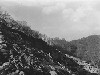 Fill settlement and slide
1951
-
 Fill settlement & slide
1951
-
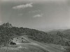 Mile High Overlook (1.3)
1952
-
 Masonic Monument, Black Camp Gap
1952
-
 Tunnel failure
1953
-
 Great Smoky Range - Panorama (Right Section of 3)
October 10, 1955
-
 Great Smoky Range - Panorama (Middle Section of 3)
October 10, 1955
Items in Query
Results: 69
Refine Your Search
Types (3)
Photographs (64) Maps (4) Newspaper Articles (1)Locations (11)
Section 2Y (22) Waterrock Knob (22) Section 2X (8) Milepost 451 (6) Milepost 455 (3) Jackson County (2) Milepost 425 (2) Big Witch Overlook (1) Milepost 448 (1) Milepost 460 (1) Sherrill Cove Tunnel (1)Sections (4)
2X (37) 2Y (26) 2Z (4) 2V (2)Counties (1)
Jackson (69)

