
Driving Through Time - The Digital Blue Ridge Parkway

Search Results:
-
 Looking south from Cranberry Ridge toward Waterrock Knob
May 12, 1945
-
 Looking south from Green Mountain lead toward Plott Balsams
May 12, 1945
-
 Looking east from Yellowface toward Fork Ridge and county line
May 12, 1945
-
 Looking east from Waterrock Knob lead toward Fork Ridge
May 12, 1945
-
 Chestnut Cutters Cabin
May 12, 1945
-
 Looking northwest from Yellowface toward Soco Gap
May 12, 1945
-
 Looking southeast from Yellowface toward Cutoff Ridge, Balsam Gap and Wesner Bald
May 12, 1945
-
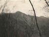
 Looking northeast from Yellowface toward Water rock Knob
-
Parkway Land Use Map Section 2-P
Page 1 of 1.
Items in Query
Results: 9
Refine Your Search
Types (2)
Photographs (8) Maps (1)Locations (4)
Milepost 451 (5) Waterrock Knob (2) Milepost 405 (1) Section 2P (1)Sections (3)
2X (7) 2P (1) 2T (1)Counties (2)
Jackson (7) Buncombe (2)

