
Driving Through Time - The Digital Blue Ridge Parkway

Search Results:
-
Land Acquisition Maps Section 2-A
1938
-
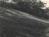
 Cumberland Knob Slope flattening at entrance
January 24, 1938
-
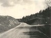
 Signs near parking area
July 1, 1938
-
 Before grading. Cleared to connect slope line, with rock as excuse for steep slope. Ugly profile.
July 25, 1938
-
 Before grading. A 3/4 to 1 slope with almost vertical overhang of soft rock
July 25, 1938
-
 Before grading. Steep, rotten rock cuts, shoulder and ditch. 2 ft short
July 25, 1938
-
 Before grading. Tape used to show concave slope. Needs transition, overhand and wide rounding
July 25, 1938
-
 Washout at headwall. Shows need of different type of structure.
August 1, 1938
-
 Before grading
December 1938
Page 1 of 1.
Items in Query
Results: 9
Refine Your Search
Types (2)
Photographs (8) Maps (1)Locations (1)
Section 2A (9)Sections (1)
2A (9)Counties (1)
Alleghany (9)

