
Driving Through Time - The Digital Blue Ridge Parkway

Search Results:
-
 Wildcat Rocks Overlook from stables parking area
April 1947
-
 Fox Hunters Paradise Highway sign (close-up)
April 1947
-
 Fox Hunters Paradise benches at overlook
April 1947
-
 Interpretive sign for Caudill Cabin at Wildcat Rocks overlook
April 1947
-
 Caudill Cabin Bldg. #100
April 1947
-
 Brinegar Cabin and Interpretive Sign
April 1947
-
 Caudill Cabin
April 1947
-
 Caudill Cabin
April 1947
-
 Guard wall
-
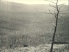
 View of The Bluffs looking north from point 200 feet off of the parkway near Alligator Back.
Items in Query
Results: 120
Refine Your Search
Types (1)
Photographs (120)Locations (36)
Milepost 237 (18) Cumberland Knob (16) Doughton Park (7) Milepost 218 (6) Section 2A (6) Wildcat Rocks Overlook (6) Milepost 217 (5) Bluffs (4) Milepost 242 (4) Fox Hunters Paradise (3) Milepost 220 (3) Milepost 224 (3) Milepost 228 (3) Basin Creek (2) Brinegar Cabin (2) Caudill Cabin (2) Milepost 219 (2) Milepost 222 (2) Milepost 223 (2) Milepost 225 (2) Milepost 226 (2) Milepost 238 (2) Milepost 241 (2) Milepost 244 (2) Pine Creek Bridge #4 (2) Section 2C (2) Alligator Back (1) Deep Gap (1) Fishers Peak (1) Hare Mill Pond (1) Intersection of Blue Ridge Parkway and North Carolina State Route 18 (near Laurel Springs, N.C.) (1) Intersection of Blue Ridge Parkway at North Carolina State Route 18 (near Ennice, N.C.) (1) Meadow Fork Valley (1) Milepost 227 (1) Milepost 229 (1) Milepost 231 (1)Sections (3)
2A (62) 2C (56) 2B (2)Counties (1)
Alleghany (120)

