
Driving Through Time - The Digital Blue Ridge Parkway

Search Results:
-
 Before Daylighting
January 30, 1947
-
 Bus terminal view from Sharp Top Road.
January 30, 1947
-
 Proposed site bus terminal.
January 30, 1947
-
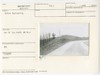
 View looking north from Sharp Top Road at a point 200 ft west of bldg. site
January 30, 1947
-
 Another view of boulder headwall inlet and 12" pipe - parking area island
May 1947
-
 Borrow pit obliteration
May 1947
-
 Another view of borrow pit obliteration
May 1947
-
 Bus terminal site before construction
May 1947
-
![Road layout grading looking toward parkwy [parkway]](https://docsouth.unc.edu/loris/blueridgeparkway/misc/0251_p_otter_mp_86.jp2/full/100,75/0/default.jpg) Road layout grading looking toward parkwy [parkway]
Road layout grading looking toward parkwy [parkway]
May 1947
-
 Boulder headwall inlet and 12" pipe - parking area island
May 1947
Items in Query
Results: 344
Refine Your Search
Types (1)
Photographs (344)Locations (32)
Peaks of Otter (71) Sharp Top Mountain (Va.) (47) Peaks of Otter Bus Station and Camp Store (30) Peaks of Otter Visitor Center (28) Peaks of Otter Lodge (Va.) (27) Peaks of Otter Campground (17) Virginia State Route 43 at Little Stony Creek (17) Milepost 86 (12) Peaks of Otter Picnic Area (12) Section 1K (11) Milepost 87 (7) Milepost 98 (6) Sharp Top Overlook (6) Flat Top Mountain (Va.) (5) Milepost 90 (5) Peaks of Otter Service Station (5) Headforemost Mountain Overlook (4) Milepost 99 (4) Pine Tree Overlook (4) Sharp Top Mountain Bus Shelter (4) Goose Creek Valley Overlook (3) Intersection of Blue Ridge Parkway at Virginia State Route 43 (3) Milepost 93 (3) Milepost 97 (3) Milepost 95 (2) Section 1J (2) Bearwallow Gap (1) Big Spring (Va.) (1) Milepost 79 (1) Milepost 94 (1) Montvale Overlook (1) Powell Gap (1)Sections (3)
1K (328) 1J (12) 1L (4)Counties (1)
Bedford (344)

