
Driving Through Time - The Digital Blue Ridge Parkway

Search Results:
-
 Work on Pier #3
1930s
-
 Access Road on Left of Parkway
1930s
-
 Building fire place, picnic area #1
1930s
-
 Layout plan, Concession Gas Station Bluff Park
1930s
-
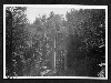
 Cliff along roadside
1930s
-
 Landscape View off of Blue Ridge Parkway
1930s
-
 Landscape View off of Blue Ridge Parkway
1930s
-
 Cumberland Knob Park Entrance
1930s
-
 North Portal Tanbark Ridge Tunnel
1930s
-
 End of Section A
1930s
Items in Query
Results: 118
Refine Your Search
Types (3)
Photographs (116) Drawings, Plans, and Projections (1) Letters (1)Locations (44)
Undetermined (18) Milepost 237 (15) Section 2A (9) Milepost 185 (6) Milepost 241 (4) Milepost 248 (4) Section 2D (4) Section 2G (4) Cumberland Knob (3) Milepost 229 (3) Milepost 272 (3) Section 2C (3) Section 2M (3) Big Laurel Gap (2) Fox Hunters Paradise (2) Milepost 218 (2) Milepost 274 (2) Section 2B (2) Section 2J (2) Bass Lake (1) Gillespie Gap (1) Hare Mill Pond (1) Linville (1) Little Switzerland (1) Mabry Mill (Va.) (1) Milepost 139 (1) Milepost 159 (1) Milepost 217 (1) Milepost 219 (1) Milepost 221 (1) Milepost 225 (1) Milepost 227 (1) Milepost 228 (1) Milepost 240 (1) Milepost 262 (1) Milepost 271 (1) Milepost 276 (1) Milepost 296 (1) Milepost 340 (1) Section 1F (1) Section 1S (1) Tanbark Ridge Tunnel (1) Tomkins Knob (1) Yonhalossee Road (1)Sections (17)
2A (26) 2C (23) 2E (10) 2D (8) 2G (7) 1U (6) 2M (4) 2B (2) 2J (2) 2L (2) 2N (2) 1F (1) 1P (1) 1R (1) 1S (1) 1T (1) 2H (1)Counties (12)
Alleghany (51) Ashe (9) Watauga (9) Patrick (7) Wilkes (6) Avery (4) Yancey (3) Floyd (2) McDowell (2) Franklin (1) Mitchell (1) Rockbridge (1)

