
Driving Through Time - The Digital Blue Ridge Parkway

Search Results:
-
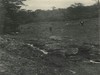 Proposed wall site
June 1938
-
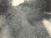
 Excavating through rock for culvert
July 28, 1938
-
 Shovel working on top of 100' cut
August 16, 1938
-
 Bear Den Cliff at proposed revision
August 16, 1938
-
 Shovel working on top of 100' cut
August 16, 1938
-
 Example of good alignment without layout but with good inspection parapet wall
August 31, 1939
-
 Example of Effective Holding In, or Fill by Laying Fill
August 31, 1939
-
 Example of good alignment without layout but with good inspection
August 31, 1939
-
Land Acquisition Maps Section 2-K
1939
-
 Example of poor alignment, even though curve has been computed mathematically wall at Bear Den P.O.
September 7, 1939
Items in Query
Results: 196
Refine Your Search
Types (3)
Photographs (193) Maps (2) Oral Histories (1)Locations (15)
Spruce Pine (37) Bear Den Campground (36) Milepost 320 (26) Section 2K (24) Milepost 319 (16) Chestoa View Parking Area (11) Heffner Gap (11) Milepost 323 (11) Milepost 318 (8) Milepost 322 (4) Milepost 324 (4) Altapass (3) Milepost 325 (2) Milepost 327 (2) McKinney Gap (1)Sections (1)
2K (196)Counties (3)
McDowell (81) Mitchell (80) Avery (35)

