
Driving Through Time - The Digital Blue Ridge Parkway

Search Results:
-
 Picnic Area
1952
-
 Terrace at bus station
1952
-
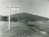 Park Entrance Sign (Parkway Emblem)
1952
-
 Gas Station
1952
-
 Flat Top
1952
-
 Polly Woods Ordinary
1952
-
 Sharp Top
1952
-
 Gas Station
1952
-
 Flat Top, Peaks of Otter
1952
-
 Sharp Top & Goose Creek Valley
1952
Items in Query
Results: 377
Refine Your Search
Types (1)
Photographs (377)Locations (32)
Peaks of Otter (82) Sharp Top Mountain (Va.) (59) Peaks of Otter Lodge (Va.) (41) Peaks of Otter Visitor Center (30) Milepost 86 (23) Peaks of Otter Campground (21) Peaks of Otter Bus Station and Camp Store (17) Peaks of Otter Picnic Area (14) Purgatory Overlook (10) Sharp Top Overlook (9) Harveys Knob Overlook (8) Milepost 90 (7) Milepost 98 (6) Peaks of Otter Service Station (6) Section 1K (5) Pine Tree Overlook (4) Bobblets Gap Overlook (3) Goose Creek Valley Overlook (3) Intersection of Blue Ridge Parkway at Virginia State Route 43 (3) Milepost 93 (3) Milepost 96 (3) Milepost 97 (3) Mills Gap Overlook (3) Big Spring (Va.) (2) Iron Mine Hollow (Va.) (2) Johnson Farm (Va.) (2) Milepost 95 (2) Powell Gap (2) Bearwallow Gap (1) Milepost 94 (1) Montvale Overlook (1) Sharp Top Mountain Bus Shelter (1)Sections (1)
1K (377)Counties (2)
Bedford (349) Botetourt (28)

