
Driving Through Time - The Digital Blue Ridge Parkway

Search Results:
-
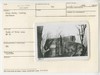
 Road to Sharp Top before construction. Slope flattening
November 15, 1946
-
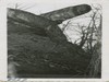 Cross rocks looking N.W.
November 15, 1946
-
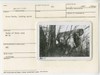 Cross rocks looking north
November 15, 1946
-
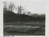
 Road from Sharp Top - before slope flattening
November 15, 1946
-
 Cross rocks, looking northeast
November 15, 1946
-
 Cross rocks, looking northeast
November 15, 1946
-
 Cross rocks, looking south
November 15, 1946
-
 Peaks of Otter bus terminal. View of native stone curbing in parking area
1947
-
 Peaks of Otter Rte 43 relocation. Site for 8x10 culvert.
January 1947
-
 Proposed site bus terminal.
January 30, 1947
Items in Query
Results: 344
Refine Your Search
Types (1)
Photographs (344)Locations (32)
Peaks of Otter (71) Sharp Top Mountain (Va.) (47) Peaks of Otter Bus Station and Camp Store (30) Peaks of Otter Visitor Center (28) Peaks of Otter Lodge (Va.) (27) Peaks of Otter Campground (17) Virginia State Route 43 at Little Stony Creek (17) Milepost 86 (12) Peaks of Otter Picnic Area (12) Section 1K (11) Milepost 87 (7) Milepost 98 (6) Sharp Top Overlook (6) Flat Top Mountain (Va.) (5) Milepost 90 (5) Peaks of Otter Service Station (5) Headforemost Mountain Overlook (4) Milepost 99 (4) Pine Tree Overlook (4) Sharp Top Mountain Bus Shelter (4) Goose Creek Valley Overlook (3) Intersection of Blue Ridge Parkway at Virginia State Route 43 (3) Milepost 93 (3) Milepost 97 (3) Milepost 95 (2) Section 1J (2) Bearwallow Gap (1) Big Spring (Va.) (1) Milepost 79 (1) Milepost 94 (1) Montvale Overlook (1) Powell Gap (1)Sections (3)
1K (328) 1J (12) 1L (4)Counties (1)
Bedford (344)

