
Driving Through Time - The Digital Blue Ridge Parkway

Search Results:
-
 Peaks of Otter. Rte 43 access to relocation. Looking west
20th Century
-
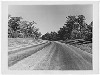
 Blue Ridge Parkway scenery
20th Century
-
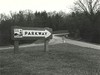
 Access Signs
20th Century
-
 Peaks of Otter. Access to relocation, looking east
20th Century
-
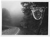
 Road
Road
20th Century
-
 Access Signs
20th Century
-
 Access Signs
20th Century
-
 Blue Ridge Parkway Sign
20th Century
-
 Cumberland Knob Park Entrance
1930s
-
 End of Section A
1930s
Items in Query
Results: 95
Refine Your Search
Types (1)
Photographs (95)Locations (52)
Mahogany Rock (7) Cumberland Knob (5) Gillespie Gap (4) Hare Mill Pond (4) Moses H. Cone Memorial Park (4) Undetermined (4) Intersection of Blue Ridge Parkway at North Carolina State Route 18 (near Ennice, N.C.) (3) Milepost 91 (3) Oteen (3) Rockfish Gap Overpass (3) Section 2A (3) Section 2C (3) Buck Creek Gap (2) Irish Gap Overpass (2) Milepost 2 (2) Milepost 248 (2) Milepost 87 (2) Rockfish Gap (2) Section 2B (2) Section 2M (2) Sumter Cabin Creek Road (2) Bluffs (1) Bluffs Coffee Shop (1) Bluffs Lodge (1) Flat Top Manor (1) Intersection of Blue Ridge Parkway at U.S. Route 70 (1) Junction of 2A/2B (1) Meadow Fork Valley (1) Milepost 159 (1) Milepost 164 (1) Milepost 206 (1) Milepost 217 (1) Milepost 221 (1) Milepost 227 (1) Milepost 229 (1) Milepost 231 (1) Milepost 238 (1) Milepost 241 (1) Milepost 255 (1) Milepost 257 (1) Milepost 276 (1) Milepost 290 (1) Milepost 327 (1) Milepost 353 (1) Milepost 36 (1) Milepost 393 (1) Milepost 417 (1) Mount Mitchell (1) Section 2D (1) Section 2E (1) Soco Gap (1) Waynesville (1)Sections (21)
2A (19) 2B (10) 2C (9) 1B (7) 2G (7) 1K (5) 2D (5) 2L (4) 2M (4) 2Q (4) 1E (3) 1R (2) 2E (2) 2N (2) 1W (1) 2F (1) 2K (1) 2R (1) 2U (1) 2W (1) 2Y (1)Counties (17)
Alleghany (39) Watauga (9) Ashe (6) Augusta (5) Buncombe (5) McDowell (5) Yancey (5) Botetourt (3) Amherst (2) Bedford (2) Floyd (2) Haywood (2) Nelson (2) Carroll (1) Mitchell (1) Rockbridge (1) Transylvania (1)

