
Fort Dobbs, Statesville
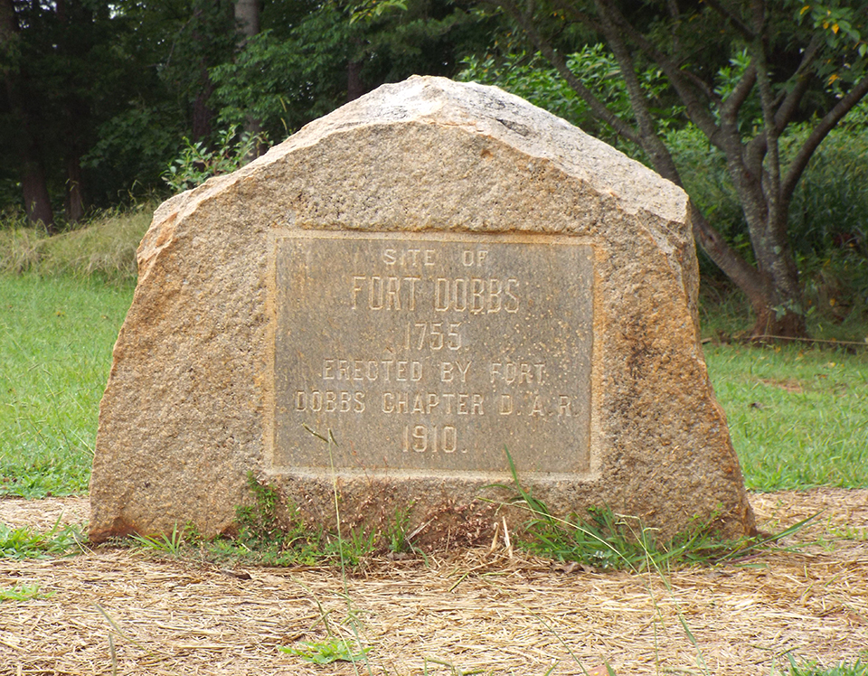
The Fort Dobbs marker is a large oval shaped granite bolder weighing about 8,000 pounds.
Including its concrete base it stands a little over three feet high. The bolder is roughhewn
except for the area containing the incised inscription.
In 1928, the Boone Trail Highway Marker (#29A) was placed on the north face of the Fort Dobbs marker.
Images (courtesy of Rusty Long and Natasha Smith):
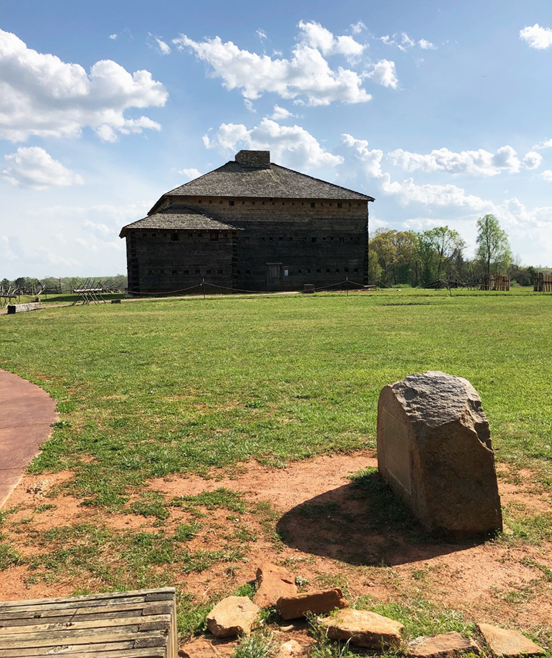
View with the fort |
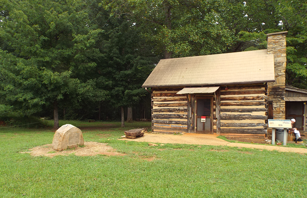
View with the Visitor center
SITE OF / FORT DOBBS / 1775 / ERECTED BY FORT / DOBBS CHAPTER D.A.R. / 1910
North Carolina State Historic site
November 3, 1910
35.821050 , -80.897320
View in Geobrowse
"Site of Fort Dobbs," The Historical Marker Database, HMdb.org, (accessed May 26, 2017) Link
Branch, Paul. “Fort Dobbs,” NCPedia.org, (accessed July 1, 2016) Link
Cashion, Jerry Clyde. “Historical Research Report for Fort Dobbs, Iredell County,” (Raleigh, NC: State Department of Archives and History, 1968), (accessed May 23, 2017) Link
Keever, Homer. “DAR Has Owned Fort Over 50 Years,” Statesville Record And Landmark (Statesville, NC), March 31, 1971
McCullough, Gary. “Iredell County,” NChistorichundred: A Regional Guide To Visiting All 100 North Carolina Counties, http://www.nchistorichundred.com, (accessed July 1, 2016) Link
“First Meeting Of D.A.RS. In Statesville, The Charlotte News (Charlotte, NC), November 4, 1910
“Fort Dobbs Marker Placed,” The Newton Enterprise (Newton, NC), October 20, 1910
“Interesting News From Statesville,” The Evening Chronicle (Charlotte, NC), October 15, 1910
Yes
Rowan County gray granite
Fort Dobbs Chapter Daughters of the American Revolution
$100
The dedication was conducted during the opening day business of the 10 th annual session of the State Congress of the Daughters of the American Revolution. The featured speaker was Rev. Plato Durham who compared the simple life of pioneers to that of the strenuous everyday modern life. The service included the reading of an historical sketch of Fort Dobbs by Mrs. C.V. Henkel and concluded with the singing of “America” and “Carolina.” Heavy rains prevented a planned automobile trip to the marker which was several miles outside of Statesville. Of note is there were probably less than 10 autos in Statesville in 1910.
The Fort Dobbs State Historic site is one of the few places in the United States preserving land
associated with the French and Indian War. The Fort was constructed in 1756 as the only
fortified outpost along the North Carolina frontier. Occupied from 1756 until 1761 when
hostilities ended the fort was involved in only one small skirmish. On February 27, 1760
Cherokee warriors attacked the fort. Three defenders were wounded and one civilian killed. On
the Cherokee side, twelve attackers were either killed or wounded.
The small plot on which the marker stands was donated to the Fort Dobbs Chapter Daughters
of the American Revolution by John W. Hatchett. After raising $1,000 they purchased an
additional 10 acres. Additional land was purchased in 1973 after the site had been acquired by
the NC Department of Archives and History.
In 1940, the Society of the Daughters of Colonial Wars erected another Fort Dobbs marker.
The memorial marker is located at 438 Fort Dobbs Rd, Statesville, NC. In 1928, the Boone Trail Highway Marker (#29A) was placed on the north face of the Fort Dobbs marker.
The 32-acre site is mostly an open field. A small wooden building which was originally the local Daughters of the American Revolution chapter house serves as a visitor center. As of 2016 plans were underway for a full-scale replica of the fort to be built on the site.
 Know anything else about this monument that isn't mentioned here? If you have additional information on
this or any other monument in our collection fill out the form at the Contact Us link in the footer. Thank you.
Know anything else about this monument that isn't mentioned here? If you have additional information on
this or any other monument in our collection fill out the form at the Contact Us link in the footer. Thank you.


