
Driving Through Time - The Digital Blue Ridge Parkway

Search Results:
-
Logical Route for the Southern Portion of the Appalachian Park-to-Park Highway
1934
-
Shenandoah-Great Smoky Mountains National Parkway, Recreational-Service-Scenic Development Peaks of Otter, Topographic and Land Map, 11/1/1934
1934
-
Appalachian National Parkway, Shenandoah-Great Smoky Mountains Section, Proposed Recreational-Service and Scenic Area, Humpback Rocks-Augusta Co. Virginia, Land Map, December 1934
1934
-
 Proposed Shenandoah - Great Smoky Mountains National Parkway
1934
-
 Perspective View of Proposed Park to Park Highway Through North Carolina
1934
-
Appalachian National Parkway, Shenandoah-Great Smoky Mountains Section, Recreation-Service-Scenic Development, Pine Spur, Land Map, Nov 1934
1934
-
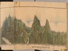 Perspective View of Proposed Blue Ridge Parkway
1934
-
 'Real Scenic Highway' Will Be Asked By N.C. (Page 2 of 2)
January 31, 1934
-
 'Real Scenic Highway' Will Be Asked By N.C. (Page 1 of 2)
January 31, 1934
-
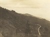 Grandfather Mtn. Lumbering operations
February 1934
Items in Query
Results: 125
Refine Your Search
Types (5)
Newspaper Articles (83) Photographs (34) Maps (5) Drawings, Plans, and Projections (2) Letters (1)Locations (21)
Asheville (18) Blowing Rock (6) Grandfather Mountain (6) Milepost 294 (5) Aho Station (3) Cherokee (3) Gillam Gap (3) Moses H. Cone Memorial Park (3) Mount Mitchell (2) Raleigh (N.C.) (2) Section 2F (2) Sherando Lake Recreation Area (2) Great Smoky Mountains National Park (1) Little Switzerland (1) Milepost 264 (1) Milepost 5 (1) Peaks of Otter (1) Section 1C (1) Section 1F (1) Section 1P (1) Sharp Top Mountain (Va.) (1)Sections (14)
2R (18) 2F (11) 2G (8) 2H (6) 2Z (4) 1C (3) 2D (3) 1K (2) 2N (2) 1B (1) 1F (1) 1P (1) 2E (1) 2L (1)Counties (12)
Watauga (19) Buncombe (18) Avery (6) Swain (4) Ashe (3) Augusta (3) Bedford (2) Yancey (2) Mitchell (1) Nelson (1) Rockbridge (1) Wilkes (1)

