Poplar Boundary Tree Marker, Cherokee
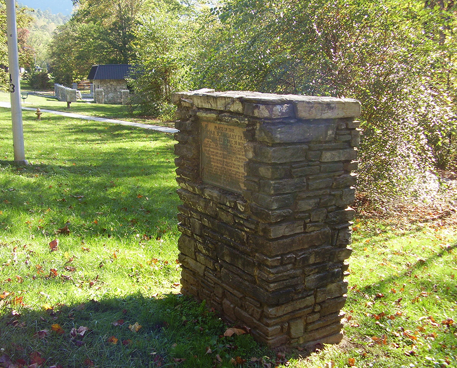
The Poplar Boundary Tree marker consists of a rectangular bronze tablet inset into a stone and masonry column approximately five-feet high. The stones were hand-hewn into bricks and blocks of random sizes.
PLACE OF THE / POPLAR BOUNDARY TREE / NORTH LAT. 35 DEG. 30 MIN. / ON SOUTHERN BOUNDARY LINE OF LANDS / ALLOTTED TO THE EARL OF GRANVILLE, ONE OF THE / LORDS PROPRIETORS, IN 1743 BY THE BRITISH CROWN. / THE DIVIDING LINE BETWEEN BURKE AND RUTHER- / FORD COUNTIES RAN HERE UNTIL 1792. / BEGINNING CORNER OF GRANTS 501 AND 502, / ISSUED TO FELIX WALKER IN 1798. / THE POPLAR WAS THE LINE DIVIDING THE / CHEROKEE AND WHITE SETTLERS AFTER 1840 / UNTIL 1946, WHEN THE PARK SERVICE CONVEYED / THE BOUNDARY TREE TRACE TO THE EASTERN / BAND OF THE CHEROKEE INDIANS. / ERECTED BY CHEROKEE HISTORICAL ASSOCIATION 1952
October 17, 1952
35.499650 , -83.311960
View in Geobrowse
“Boundary Tree Ceremony to Be Held at Cherokee,” Asheville Citizen-Times (Asheville, NC), October 12, 1952
“Boundary Tree Marker Unveiled in Cherokee,” Asheville Citizen-Times (Asheville, NC), October 18, 1952
“Marker Event Planned Today in Cherokee,” Asheville Citizen-Times (Asheville, NC), October 17, 1952
“Place of the Poplar Boundary Tree Historical Marker,” The Historical Marker Database, HMdb.org, (accessed January 16, 2022) Link
Yes
Bronze, hand-hewn stone bricks, masonry
Cherokee Historical Association
The main address was by Ernest Bird, president of the Western NC Historical Association. The State Department of Archives and History sponsored the event and Mrs. Sadie Patton of Hendersonville presented the tablet on their behalf.
The marker stands near the spot where a tulip poplar tree marked the boundary line between the Cherokee Indians and white settlers. At the time of the dedication the tree was still present although in poor condition. The location of the tree no longer marks the current boundary of the Cherokee Indian Reservation.
The marker is across the street from the intersection of Boundary Tree Road with Tsali Blvd. (US Highway 441), Cherokee, NC 28719
The memorial marker stands on grass near wooded park area.
 Know anything else about this monument that isn't mentioned here? If you have additional information on
this or any other monument in our collection fill out the form at the Contact Us link in the footer. Thank you.
Know anything else about this monument that isn't mentioned here? If you have additional information on
this or any other monument in our collection fill out the form at the Contact Us link in the footer. Thank you.