
General Hull and Thomas Holliday Marker, Snow Hill
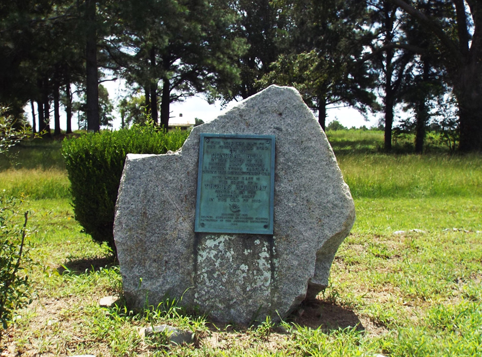
A simple bronze plaque is attached to a large, irregular shaped four foot high rock. In addition to the inscription the plaque has the spinning wheel insignia of the Daughters of the American Revolution.
Images:
Plaque |
Angle view |
Civil War Trails marker |
Far-off view
THIS ROAD WAS PART OF / THE ORIGINAL HULL ROAD / CUT BY / GENERAL HULL / IN THE MARCH OF THE / BRITISH ARMY THROUGH / EASTERN NORTH CAROLINA / DURING THE REVOLUTIONARY WAR
TWO MILES EAST IS / THE GRAVE OF / THOMAS HOLLIDAY / GENERAL IN THE / AMERICAN ARMY / IN THE WAR OF 1812
ERECTED BY THE / COLONEL ALEXANDER MCALLISTER CHAPTER / DAUGHTERS OF THE AMERICAN REVOLUTION / 1930
June 3, 1930
35.481390 , -77.638810
View in Geobrowse
“Boulder Ready for Exercises,” The News and Observer (Raleigh, NC), June 1, 1930
“Hull Road,” Historical Marker Project, http://www.historicalmarkerproject.com, (accessed August 20, 2016) Link
“Hull Road,” The Historical Marker Database, HMdb.org, (accessed August 20, 2016) Link
“Patriotic Marker and Its Unveilers,” The News and Observer (Raleigh, NC), June 8, 1930
Yes
Bronze, granite
Colonel Alexander McAllister Chapter, Daughters of the American Revolution
The marker is located near Snow Hill, NC, at the intersection of U.S. 258 and County Route 903, on the right when traveling north on U.S. 258. The Greene County Courthouse is app. six miles south on Highway 258 (see Greene County Confederate Monument). A North Carolina Civil War Trails sign stands a few feet from the marker. Nooherooka Monument is app. five miles from the marker.
The landscape is open farmland on all sides with the exception of an abandoned house about 100 yards behind the marker.
 Know anything else about this monument that isn't mentioned here? If you have additional information on
this or any other monument in our collection fill out the form at the Contact Us link in the footer. Thank you.
Know anything else about this monument that isn't mentioned here? If you have additional information on
this or any other monument in our collection fill out the form at the Contact Us link in the footer. Thank you.


