Tryon Peak Treaty, Tryon
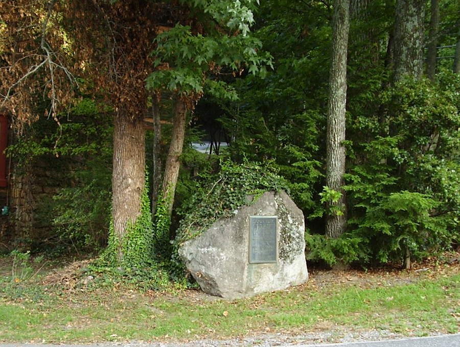
The Tryon Peak Treaty marker is an unadorned bronze plaque attached to a very large flat faced boulder standing approximately five-feet tall that roughly forms the shape of a blunt arrowhead.
Tryon Peak / ON ITS SUMMIT / IN JULY, 1767 / A TREATY WAS MADE BETWEEN / ENGLISH OFFICERS AND / CHEROKEE CHIEFS. / ESTABLISHING WHERE THE / EXTREME WESTERN FRONTIER / FOR WHITE SETTLERS. / THE MOUNTAIN WAS NAMED / FOR / WILLIAM TRYON / THEN ROYAL GOVERNOR / OF THE PROVINCE OF / NORTH CAROLINA. / ERECTED BY UNAKA CHAPTER / N.C. SOCIETY, DAUGHTERS / OF AMERICAN COLONISTS.
April 30, 1951
35.222450 , -82.252870
View in Geobrowse
"Agreement between North Carolina and the Cherokee Nation concerning the boundary between North Carolina and Cherokee land Cherokee Indian Nation; North Carolina, June 13, 1767. William Saunders, ed., The Colonial Records of North Carolina, vol. 7 (Raleigh, N.C.: P. M. Hale, Printer to the State, 1886), pp. 469-471. Documenting the American South, http://docsouth.unc.edu Link
“Historical Marker Unveiled in Polk by Cherokee Chief,” Asheville Citizen-Times, May 1, 1951
“Indian Treaty Marker Will Be Unveiled,” Asheville Citizen-Times, April 29, 1951
“Treaty Marker Unveiling Set in Polk Today,” Asheville Citizen-Times, April 30, 1951
“Tryon Peak,” The Historical Marker Database, HMdb.org, (accessed February 22, 2017) Link
Yes
Granite, bronze
Unaka Chapter #2, N.C. Society Daughters of American Colonists
The invocation by Rev. Arsene Thompson of Cherokee was in his native Indian tongue and Henry Bradley, Chief of the Eastern Band of the Cherokee with Mrs. Asbury Barnett of Asheville performed the unveiling. Speakers included C.P. Rogers, chairman of the Polk County Historical Association, D. Hiden Ramsey, Asheville Citizen-Times company official and Dr. C.C. Crittenden, director of the State Department of Archives and History. Crittenden said the marker would remind people that North Carolina is “rich in her history and rich in the interest of the people to mark spots where a historical event has taken place.” Ramsey noted that North Carolina has much history in “which she is not so proud but also much of which she is very proud.” Marking the spot of the treaty was included among the proud moments in history.
The Treaty of Tryon was an attempt to establish a definitive line between white settlers and Indians and also fix the western frontier of North Carolina.
The marker is located northwest of Tryon, NC, at the intersection of Harmon Field Road and North Trade Street (U.S. 176)
The maker sets under a cover of trees and is partially covered with ivy at a V shaped intersection.
 Know anything else about this monument that isn't mentioned here? If you have additional information on
this or any other monument in our collection fill out the form at the Contact Us link in the footer. Thank you.
Know anything else about this monument that isn't mentioned here? If you have additional information on
this or any other monument in our collection fill out the form at the Contact Us link in the footer. Thank you.