
Driving Through Time - The Digital Blue Ridge Parkway

Search Results:
-
 Scenic View, Overlook 829
1940s
-
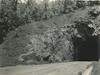 North portal Tanbark Ridge Tunnel
1940s
-
 Looking north on Parkway
1940
-
 Looking south on Parkway
1940
-
 North portal Tanbark Ridge Tunnel
1940s
-
 Looking North on Parkway
1940
-
 Looking North on Parkway
1940
-
 Parkway Nears Its Final Stage
April 30, 1940
-
 Headquarters Site
June 1940
-
 Headquarters Site
June 1940
Items in Query
Results: 609
Refine Your Search
Types (4)
Photographs (575) Newspaper Articles (15) Maps (13) Oral Histories (6)Locations (58)
Asheville (164) Craggy Gardens Visitor Center (109) Craggy Gardens (49) Milepost 388 (26) Folk Art Center (25) Oteen (25) Milepost 374 (23) Craggy Mountains (18) Intersection of Blue Ridge Parkway at U.S. Route 70 (12) Craggy Pinnacle (11) Section 2P (9) Craggy Knob (8) Craggy Picnic Area (7) Craggy Pinnacle Tunnel (6) Lanes Pinnacle Parking Overlook (6) Milepost 382 (6) Section 2Q (6) Milepost 359 (5) Milepost 375 (5) Pinnacle Gap (5) Section 2T (5) Black Mountain (4) Milepost 360 (4) Milepost 363 (4) Milepost 377 (4) Tanbark Ridge Overlook (4) Asheville Airport (3) Bee Tree Gap (3) Craggy Dome Parking Overlook (3) French Broad River (3) Milepost 358 (3) Milepost 373 (3) Milepost 380 (3) Section 2R (3) Section 2S (3) Swannanoa Storage Area (3) Bull Gap (2) Craggy Dome (2) Milepost 362 (2) Milepost 364 (2) Milepost 365 (2) Milepost 390 (2) Milepost 393 (2) Asheville Civic Center (1) Bent Creek Forest (1) Biltmore Estate (1) Buncombe County (1) Craggy Flats (1) Craggy Flats Tunnel (1) Elk Mountain Scenic Road (1) Milepost 357 (1) Milepost 367 (1) Milepost 368 (1) Milepost 371 (1) Milepost 392 (1) Milepost 398 (1) Milepost 403 (1) Milepost 405 (1)Sections (6)
2P (297) 2R (203) 2Q (89) 2S (8) 2T (7) 2N (5)Counties (1)
Buncombe (609)

