
Driving Through Time - The Digital Blue Ridge Parkway

Search Results:
-
Public Road System Plan
1947
-
Parkway and Local Road Relocation
1948
-
Land Acquisition Maps Section 2-Q
1948
-
 Craggy Picnic Area
1950s
-
 Mosses and Ferns
1950s
-
 Craggy Dome Parking area wall
1950s
-
 Craggy Dome Parking area wall
1950s
-
 Craggy Gardens Visitor Center
1950s
-
 Craggy Dome
1950s
-
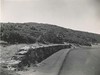
 New Stretch Of Parkway To Be Opened
January 15, 1950
Items in Query
Results: 591
Refine Your Search
Types (4)
Photographs (558) Newspaper Articles (14) Maps (13) Oral Histories (6)Locations (57)
Asheville (161) Craggy Gardens Visitor Center (109) Craggy Gardens (48) Milepost 388 (26) Folk Art Center (25) Oteen (24) Milepost 374 (21) Craggy Mountains (18) Craggy Pinnacle (11) Intersection of Blue Ridge Parkway at U.S. Route 70 (10) Craggy Knob (8) Craggy Picnic Area (7) Section 2P (7) Craggy Pinnacle Tunnel (6) Lanes Pinnacle Parking Overlook (6) Milepost 375 (5) Pinnacle Gap (5) Section 2Q (5) Section 2T (5) Black Mountain (4) Milepost 363 (4) Milepost 377 (4) Milepost 382 (4) Tanbark Ridge Overlook (4) Asheville Airport (3) Bee Tree Gap (3) Craggy Dome Parking Overlook (3) French Broad River (3) Milepost 358 (3) Milepost 359 (3) Milepost 360 (3) Milepost 373 (3) Milepost 380 (3) Section 2R (3) Section 2S (3) Swannanoa Storage Area (3) Bull Gap (2) Craggy Dome (2) Milepost 362 (2) Milepost 364 (2) Milepost 365 (2) Milepost 390 (2) Milepost 393 (2) Asheville Civic Center (1) Bent Creek Forest (1) Biltmore Estate (1) Buncombe County (1) Craggy Flats (1) Craggy Flats Tunnel (1) Elk Mountain Scenic Road (1) Milepost 357 (1) Milepost 367 (1) Milepost 368 (1) Milepost 371 (1) Milepost 392 (1) Milepost 398 (1) Milepost 403 (1)Sections (6)
2P (289) 2R (200) 2Q (83) 2S (8) 2T (6) 2N (5)Counties (1)
Buncombe (591)

